Ukraine update: Blowing up the bridge at Borova
This post was originally published on this site
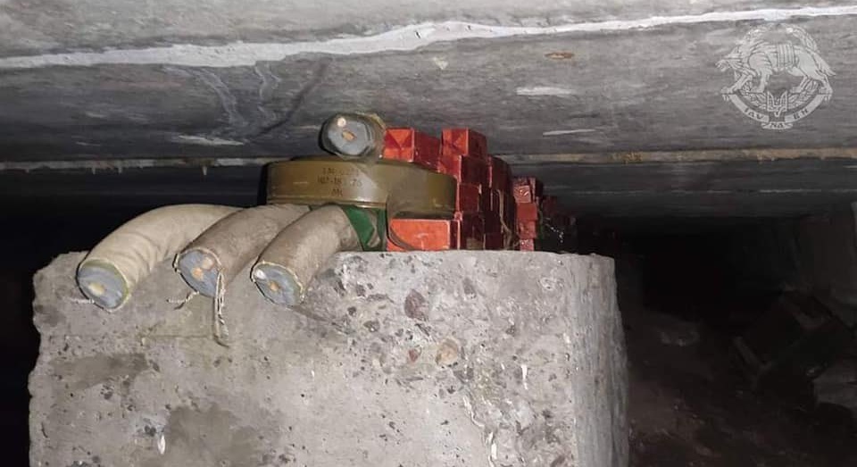
On Wednesday, the Ukrainian government circulated images of a destroyed bridge somewhere in the Donbas region—a bridge that had been taken down by Ukrainian special forces. Not only was the bridge itself destroyed, it was taken down as a Russian convoy was passing over, destroying four large trucks and a Tigr-M (sort of the Russian equivalent of a Humvee).
In the hours following the images’ release, most attention focused on the loss of the vehicles in the convoy and the idea that Ukrainian special forces were able to slip through Russian lines to strike a target in an area of Russian control. But as it became clear just which bridge this was, the importance of this strike—and how it plays into the greater story of what’s happening in eastern Ukraine—becomes far more obvious.
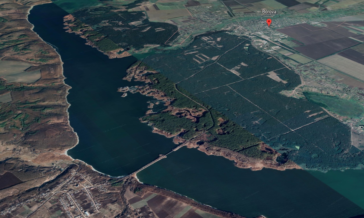
This is the bridge in question. It spans the broad Oskil Reservoir between the town of Borova on the eastern bank, and the village of Bakhtyn on the west. Before the invasion, both areas would have been under Ukrainian control. It’s about 50 miles north of Russian-occupied areas in Luhansk oblast. But Russian forces moved swiftly up the eastern side of the Oskol River during the first days of the invasion, and Borova has been nominally in their pocket for some time, though this area between the river and the P66 highway about a dozen miles to east has remained in dispute.
What makes this bridge so important becomes somewhat obvious when you see it in slightly broader context.
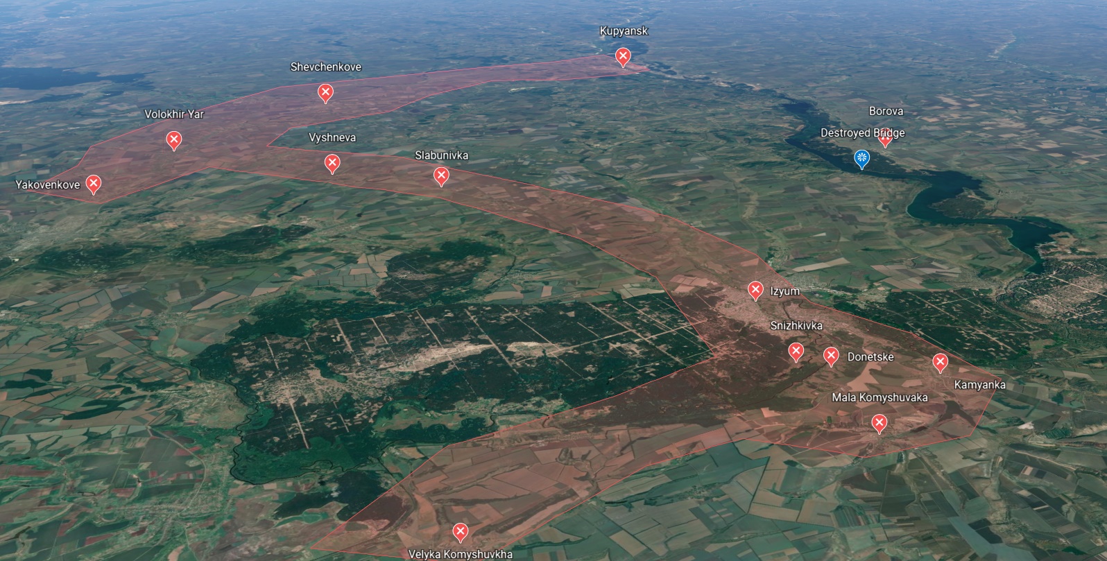
The pinkish area in this image represents roughly the outline of that “Izyum salient” — the extension of Russian forces south of Kharkiv that has allowed Russia to pile up armor and men at sites around the recently captured town of Izyum. Russia would like to push this salient south or west, allowing them to cut off a big chunk of eastern Ukraine and trap Ukrainian troops located along the defensive lines to the east. Originally, it seemed like Russia intended to continue south toward Slavyanka or Kramatorsk (which was risky). More recent reports have indicated Russia intends to push west for Dnipro (which seems suicidal).
But no matter which way Russia moves, it clearly has to keep its supply lines open. Right now, that line pokes into disputed territory at Kupyansk and cuts west to Volokhir Yar before turning south along the M03 highway. This is a long and complex route. It’s also subject to be sliced in half by Ukrainian forces moving south from Kharkiv. It’s not a good way to begin a move that has to stretch for another 100 miles or more and be sustained in the field for weeks.
What would help? A shorter route. One that could act as both a bonus and an alternative in case that Volokhir Yar crossroads falls. Something like … that bridge west of Borova.
With that bridge, Russia had an alternative means of bringing in supplies that not only made the trip to Izyum shorter on the west side of the Oskil, but meant that the start of the salient would be much closer to their long-held area in Luhansk than the current starting point at Kupyansk. It would cut miles off their route in both directions, and make the whole salient more sustainable. Which is, without a doubt, why Ukraine thought it was worthwhile to get in there and take that bridge out.
Of course, there is a possibility that Russia could simply work around it. Here are a couple of images of the area south of Izyum. First, an image of the area just southwest of the city from Google Earth that is just over a year old:
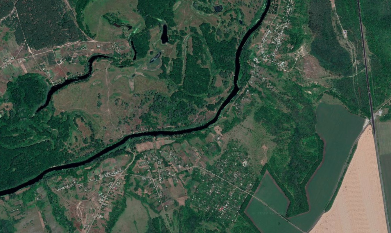
That dark line is, of course, the river that flowed around the south half of Izyum and kept Russia from taking all of the city for several weeks. Now, here’s a low-resolution version of some imagery from Maxar Technologies that was taken just a week ago.
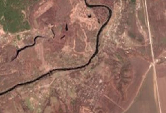
The second image is a lot browner, because things are only starting to green up in the area. However, that’s not the critical difference I want to point out. The big difference is actually something quite small. Do you see it? About one-third of the way over from the left there’s a light band running down to the river. And over the river itself, there’s a thin line. That line is a pontoon bridge. And that broad band of lighter color shows where a large number of Russian vehicles crossed the bottomlands, then drove across that quickly erected bridge to connect to a small road on the south side of the river. That’s what allowed them to get around the town’s defenders and eventually take the city—reportedly with the help of someone who helped them locate this low water crossing.
Russia could definitely do something similar to the east of Izyum. They could create a pontoon bridge across the Oskol river, likely somewhere south of Borova. Or they could cross the existing bridge at the town of Oskil, which is very close to Izyum and and an even shorter distance from Russian-held territory. Except … Russia doesn’t seem to have been able to bring forces across that bridge. In the latest low-res imagery, that bridge appears to be possibly damaged near the east shore. Also, it’s even close to those defensive positions Ukraine occupies on the eastern border than it is to Russian-occupied territory. Finally, it’s also a long trip through disputed areas for forces entering Ukraine near Kharkiv.
It was always clear that, no matter which way Russia wanted to move in its effort to grab the Donbas region, that effort would run through Izyum. It’s a good bet that Russia never would have gone all the way up to Kupyansk if it could have moved forces down effectively through the bridge at Oskil. Maybe the bridge is down. Maybe there’s too much Ukrainian opposition in the area. Whatever the reason, Kupyansk was where they went first, and Borova was what they tried to capture to both increase the flow of supplies and provide a backup.
Which is something Russian forces might sorely miss … when they are forced to retreat.
